Landscape Services
Landscape Planning
Strategic Landscape Consultancy
Landscape & Visual Impact Assessment
Environmental Statements
Landscape Design
Landscape Management Plans
Visualisations
Landscape Planning
At EC Environmental, we understand the importance of comprehensive site analysis in the early stages of development planning. It is paramount to maximize the site's value, pre-empt costly objections, and achieve successful planning outcomes. Given the mounting legislative, environmental, and social pressures on land use, grasping the intricacies and context of each site becomes imperative. We specialize in identifying the unique landscape challenges and opportunities inherent to each site, aiding in navigating constraints and capitalizing on potential benefits. Our expertise can be instrumental in ensuring a well-informed approach to development that aligns with regulatory requirements and environmental sustainability goals.

Strategic Land Consultancy
At EC Environmental, we expand upon our Landscape Planning service by collaborating with specialized land promotion companies to facilitate the promotion of land for allocation or outline planning permission. Whether you are considering development for new homes, renewable energy, or other purposes, our objective is to assist in promoting sites through the planning system with the goal of securing the most favourable planning permission possible. Contact EC Environmental to discuss how we can help.

Visualisations
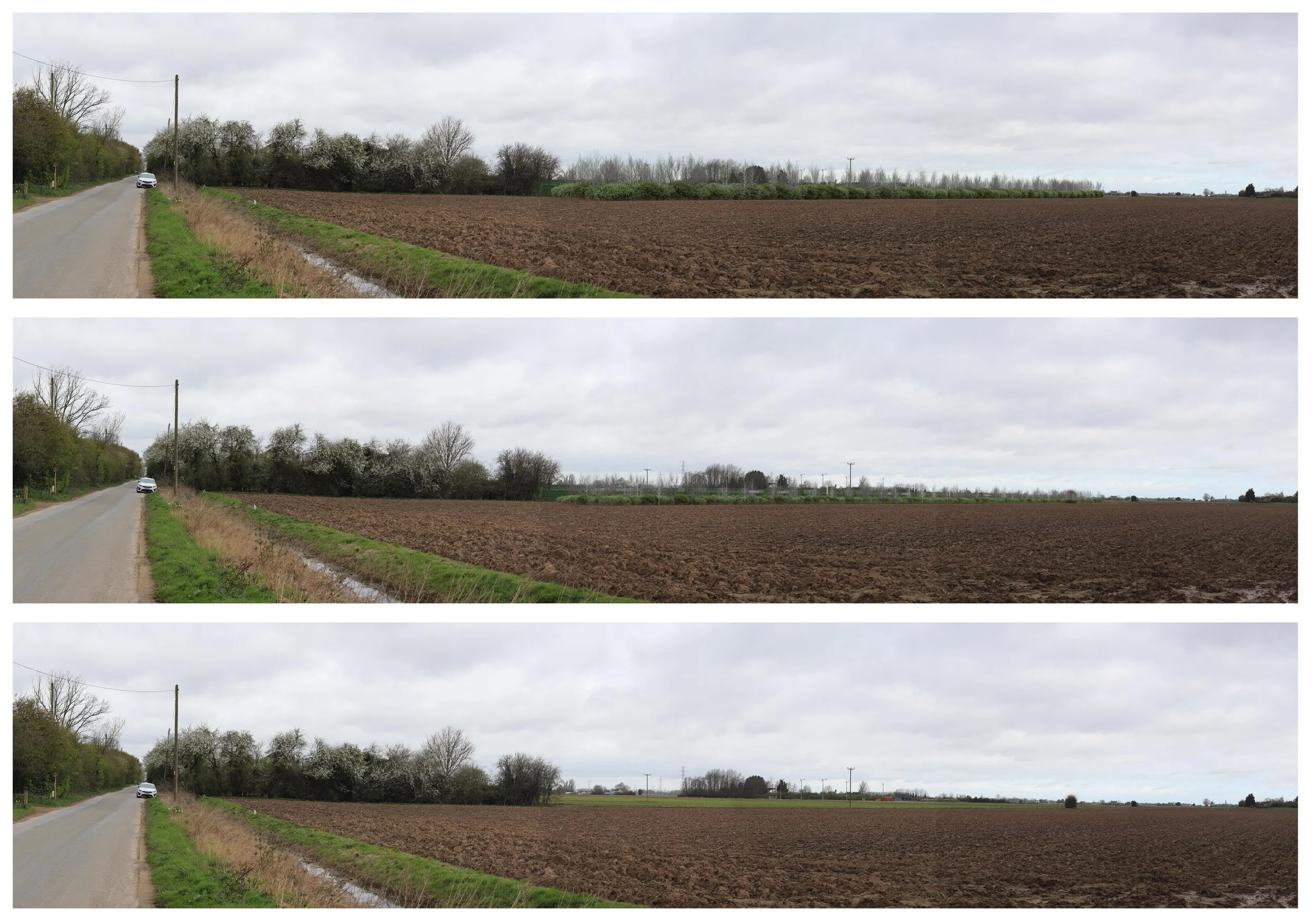
EC Environmental we can provide visualisations including AVR in support of Landscape and Visual Impact Assessments (LVIA). Visualisations play a crucial role in Landscape and Visual Impact Assessments (LVIA) helping to clearly communicate how a proposed development will appear within its setting. Guided by the Landscape Institute’s standards, visualisations range from annotated viewpoint photographs and 3D wirelines to detailed photomontages. These illustrate anything from the basic outline and form of a proposal (Types 1–2) to highly accurate, survey-based images that show true scale, materials, and context (Types 3–4).
An Accurate Visual Representation (AVR), also known as a verified view, is a precise, scaled image that demonstrates the location, visibility, form, and materials of a proposed development. The London View Management Framework defines four AVR levels, ranging from a simple photowire showing position and size (Level 0) to a fully rendered, photo-realistic image depicting architectural detail and material finishes (Level 3). Together, these visualisation techniques provide a transparent and credible basis for assessing the visual impact of development proposals.
Landscape & Visual Impact Assessment Environmental Statements
Landscape and Visual Impact Assessment (LVIA) and Townscape and Visual Impact Assessment (TVIA) play a crucial role in evaluating the potential impact of new developments on the visual and scenic qualities of an area. Through LVIA, potential visual and material impacts of the development are identified, and measures to mitigate or minimize these impacts are carefully considered. At EC Environmental, our experienced team is dedicated to providing expert assistance in LVIA, TVIA and Environmental Impact Assessments.

Landscape Design
Providing conceptual, strategic and detailed landscape design for developments of various sizes. This includes conceptual design, detailed landscape design accommodating sustainable drainage, ecological enhancements and the creation of accessible green spaces and promoting sustainable transport usage between the new and existing settlements. Landscape and Ecological Management Plans for the long term enhancement of the landscape and ecological value can also be provided. EC Environmental can provide detailed design at Outline Planning, Reserved Matter Stages and beyond.